Last Tuesday, January 22, the city of Bucaramanga, Santander was rudely awoken at 6.10am by a 13-second earthquake, registering 4.5 on the Richter scale.
Little did the people of Santander know, this tremor was to become part of a series of moderate earthquakes that have been registered across Colombia over the past week, each with varying magnitudes.
The first of the series of seismic shocks took place on Monday, January 21 with its epicentre in the Los Santos region of Santander, measuring a magnitude of 3.5. Subsequent quakes continued to be felt in Colombia’s central and southern regions; Cundinamarca, Cauca, Neiva, Tolima, Huila and the Coffee Region.
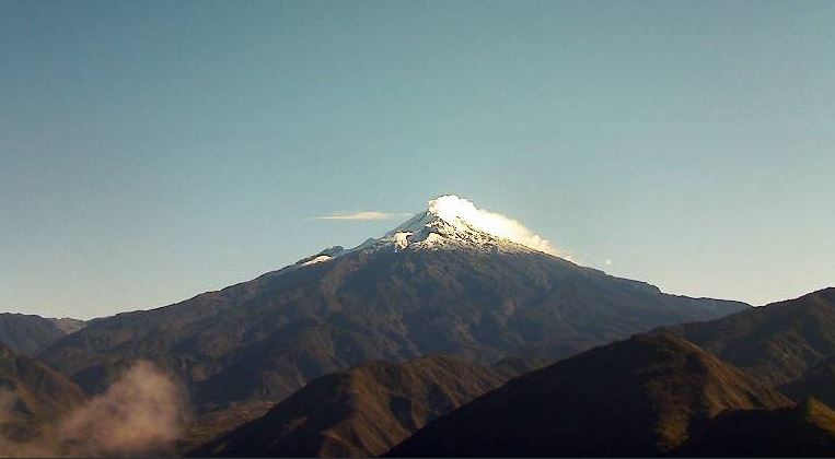
Perhaps the most notable tremors took place on Saturday, January 26. According to the Colombian Geological Service, some epicentres had volcanic origins, with one of the largest located approximately 13.5 kilometres north-east of the Nevado del Huila volcano peak, situated in the Los Nevados national park. A Richter scale magnitude of 5.4 and depth of approximately 9 km were also registered. This same day, however, a quake of almost equal strength also occurred in the Planadas region of Tolima, measuring 5.5 in magnitude.
According to reports by El Tiempo, the series of earthquakes did not claim the lives of any victims, but did leave material damage in some areas of the country. January 26 saw damage to housing located in Toribío, Cauca and the towns of Teruel y Yaguará, Huila. Subsequent reports of buildings and a church affected also came to light after quakes in the department of Tolima, Monday January 27.
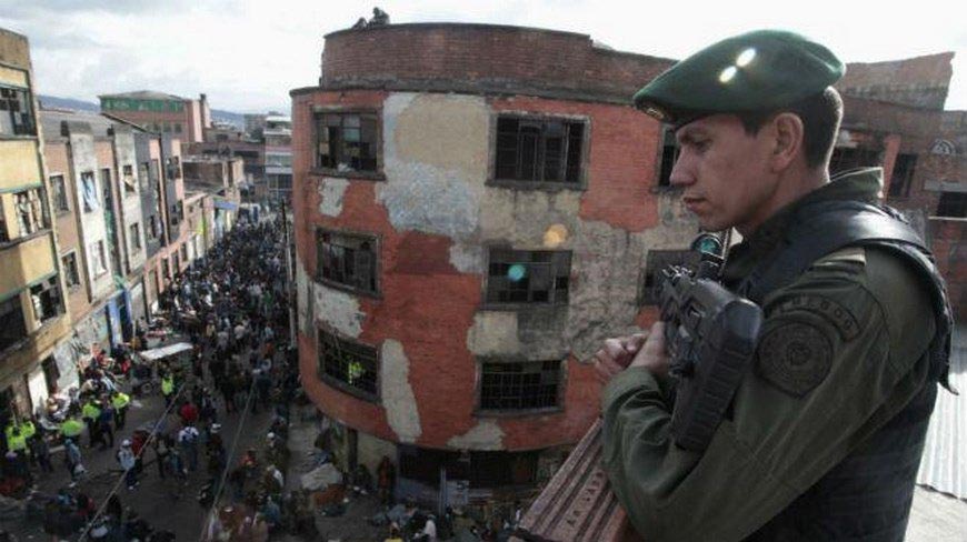
However, on the afternoon of January 28, aftershocks of further quakes in both the Nevado del Huila volcano and the Planadas region were felt in the Colombian capital as buildings began to visibly shake. Although offices were evacuated by workers in both Bogotá and Cali, the emergency telephone line 123 received no calls.
In total, 62 earthquakes occurred over the 10-day period spanning from January 21 until 31, according to the Colombian Geological Service Twitter account. This sheer quantity of seismic activity sparked enough concern for fake news bulletins and warnings to begin to circulate their way around WhatsApp and social media.
“The next 72 hours will be critical as we are on high alert. Make sure you have a first-aid kit to hand and a hand-held torch, because it is estimated that all of Colombia will experience an earthquake, affecting various states of the Republic,” read a warning from unverified Facebook news outlet Noticias Sincelejo 24 Horas circulating on Whatsapp.
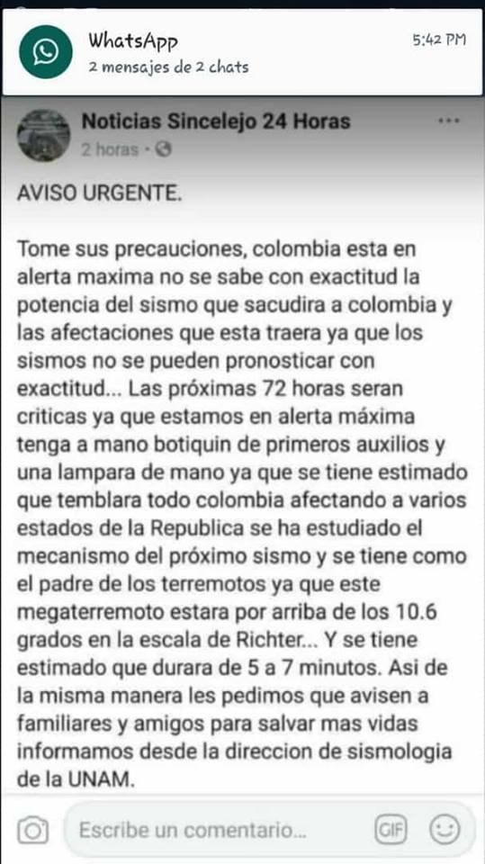
“The movement of the next earthquake has been studied and the father of all earthquakes looks to be coming. It will be over 10.6 on the Richter scale and is estimated to last between 5 and 7 minutes. Similarly, we ask you to let family members and friends know in order to save more lives, we communicate this from the seismology department at the UNAM (National Autonomous University of Mexico).”
Contrary to the above information, authorities did not raise alerts for the zones affected from the standard yellow, or level III, as they are naturally located in an area of tectonic activity.
Speaking to Cable Noticias’ programme ‘La Otra Cara,’ Coordinator of the Colombian Geological Service’s National Seismographic Network, Viviana Dionicio, put the unusually high amount of earthquake activity this month down to Colombia’s natural geography.
As a result of Colombia’s location, two tectonic plates – the Nazca Plate and the South American plate – are always moving and naturally bump into each other, Dionicio explained. As a result, the two plates are in a process of “constant collision,” thus accumulating energy.
Using the metaphor of bending a ruler until it snaps, Dionicio then described the process of how an earthquake occurs. As a country, this is particularly applicable to Colombia due to its geological faults, topography and geographical location.
However, speaking to Semana, the Colombian Geological Service’s technical director of Geohazards Marta Lucía Calvache maintained that not all of the quakes have, in fact, been related. The tremors occurring in Santander “have their own characteristics and generate their own seismic shocks, and those in Tolima are happening in another region,” she told the magazine, suggesting the quantity could have just been a mere coincidence.
Although the Colombian Civil Defense services warn that it is not possible to predict an earthquake, advice on how to best prepare can be found below.